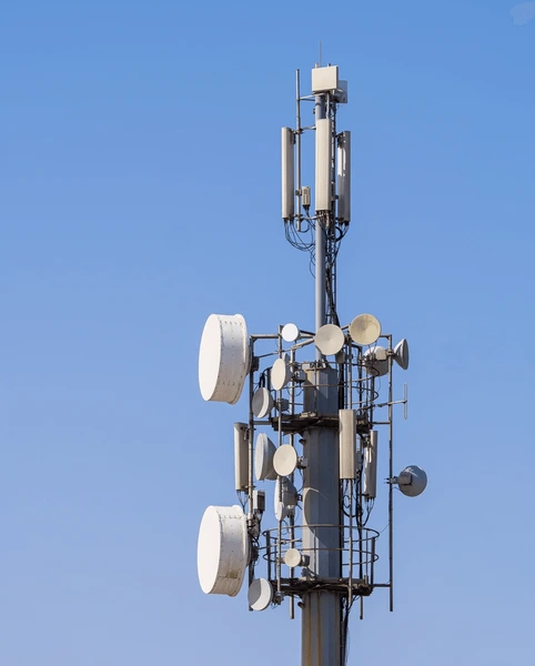
NARROWED BASE STATION AREA ANALYSIS Technical Realities, Methodological Limits and Legal Implications Interview Keywords: Narrowed Base Station • HTS • Base Station • Location Determination • Digital Evidence EDITOR'S NOTE: The method of "narrowed base station area analysis", which has come onto the agenda recently in various criminal investigations, is the subject of intense public debate. This interview has been prepared to convey the technical realities of the subject, the limits of what is currently possible and the legal dimensions, from the perspective of an independent telecommunications expert. No reference is made to any case, person or institution; the aim is to inform the public about the technical facts.
I. Conceptual Framework: What Does "Narrowed Base Station" Mean?
QUESTION: What exactly does the term "narrowed base station area analysis", heard so often lately, mean? Does the concept have an established place in the technical literature? No, it does not. To answer directly: expressions such as "narrowed base station", "narrowed base station area" or "narrow-area base station analysis" are not defined as technical concepts in the international telecommunications engineering literature, in 3GPP standard documents, in IEEE publications or in any academic source. These terms entered circulation together with reports produced in particular criminal investigations, and thereafter began to be discussed in the media and in public as though they were an established technical method.
What does exist in the technical literature is this: there are various methods for estimating the approximate area in which a mobile phone may be located, using the base station to which it is connected. Foremost among these are coarse Cell-ID-based location estimation, distance ringing with the Timing Advance parameter, and trilateration in which the signals of multiple base stations are assessed together. None of these, however, can determine exactly and definitively where a person was standing at any given second — which street, which building, which floor, which room. As of today, no technology enabling this can be derived retrospectively from the HTS records of GSM/UMTS/LTE/5G networks. TECHNICAL SUMMARY: "Narrowed base station" is a term with no counterpart in international technical standards or in the academic literature. Making a definitive, narrow-area location determination retrospectively from existing HTS data is not possible with today's technological means.
QUESTION: Then why does public perception point the other way? Where does the impression that "the base station tracks me room by room" come from? This perception has several sources. The first is confusion between the GPS and Wi-Fi location services on smartphones and the GSM base station record. When a phone application shows you on a map with centimetre accuracy, that comes from the operation of the GPS receiver. GPS uses satellite signals and gives real-time position; assessing that together with an HTS record is a technical fallacy. The second is the "digital watches everything" perception created by Hollywood films and police dramas. In real life the only thing a base station record records is this: this phone was, on this date and at this hour, within the coverage area of this base station. Full stop. That coverage area can have a diameter of several hundred metres even in a dense neighbourhood of a large city, and can exceed tens of kilometres in a rural area.
The third and perhaps most important source is the presentation of the method in some forensic reports as though it were a technique of proven scientific validity. The inclusion of such reports in court proceedings lends the method an apparent legitimacy. Yet the acceptance of a method as evidence in court does not prove its scientific correctness; scientific correctness is established by peer review within the scientific community. II. Technical Realities: Why Is It Not Possible?
QUESTION: Technically, why can a definitive location determination not be made? Can we not calculate distance using base station signal information?
This must be addressed in several layers. Let us first make clear what data the operator records in a standard HTS record. Essentially these are: the time and date at which the call began, the duration of the call, the calling and called numbers, and the identity (Cell-ID) and sector of the base station through which the connection was established. That is all.
There is a critical omission here: signal strength (the dBm value) does not appear in most operator records. Without signal strength you cannot calculate distance. But could the calculation be made even if signal strength were present? No, it would not be sufficient. Let me explain. How strong or weak a radio signal will be at a given distance does not depend on distance alone. The obstacles the signal encounters along its path — buildings, trees, a tunnel, a bridge, a body of water — both attenuate it and reflect it in different directions. This physical phenomenon is known as multipath propagation. The result is this: you may receive the same signal level both 50 metres and 500 metres from the base station. Even if two measurements give the same value, your physical position may be at entirely different points. Moreover, the factors affecting signal strength are not constant. Humidity, rain, fog, wind, seasonal changes — a tree that is bare in autumn affects the signal differently when in leaf in spring — all of these continuously alter the signal strength received at the same point. The value you measure today may not correspond to the value that applied in the past when the incident occurred. A retrospective signal strength analysis therefore has no verifiability.
A LAW OF PHYSICS: A radio signal can show the same strength at physically different locations. This is not a limit of measurement precision; it is a consequence of a fundamental law of physics. No software or algorithm can eliminate this uncertainty. QUESTION: Is narrowing not possible by taking retrospective signal measurements, that is, by going to the site after the date of the incident?
This question is very important, because some reports contain the statement that "signal measurements were taken by going to the scene after the date of the incident". This is fundamentally problematic in technical terms and is an invalid approach.
There are several reasons. First, network topology changes over time. Base stations are upgraded, new antennas are added, old antennas are removed, antenna angles and power levels are optimised. The measurement you take at the scene today does not reflect the network structure on the date of the incident. This difference can become marked in urban areas within just a few months. The second reason is environmental variables. As I explained just now: weather conditions, season, even the traffic load at the time of day affect the signal. You cannot claim to have recreated a past moment.
The third and most fundamental reason is this: measuring a given signal level at one point does not change the fact that the same signal level may also be observed at thousands of other points within the base station's coverage area. A single measurement value does not give you a single location; there are hundreds of different locations consistent with that value. Academic studies conducted on university campuses show that the same signal level appears at dozens of different locations across 1,500 different measurement points. You cannot invert this and say "if this signal was received here, this person was definitely at that point".
QUESTION: What about trilateration? Is finding the intersection point of multiple base stations not a solution?
Trilateration is a method that attempts to estimate position using distance estimates from multiple base stations. GPS systems work on this principle and achieve sub-metre accuracy thanks to very strong satellite signals carrying precise timing information. But for retrospective trilateration using GSM/LTE base station data, two fundamental conditions are missing. The first condition: simultaneous signal measurements from multiple base stations for the terminal must be present in the records. This information is not in the standard HTS record; the record contains only the station through which the connection was established, not the neighbouring stations measured in the background. Neighbour Cell Measurement logs are not data that operators keep as standard.
The second condition: exact and accurate signal strength values must be known for a precise distance calculation. Because of the multipath propagation and environmental variables described above, these values do not accurately reflect true distance. In a standard GSM/LTE HTS record signal strength is not recorded in any case. Where these two conditions cannot be met, trilateration amounts to no more than a mathematical construct; its result reflects assumptions rather than actual location. Table 1. Comparison of HTS Records with Real-Time GPS Location Determination Criterion GPS (Real Time) HTS / Base Station Record Location accuracy < 5 metres (open area) 100 m – 35+ km (coverage area) Data source Satellite signal (multiple, simultaneous) Single base station (moment of connection) Retrospective analysis No — real time Yes — but verification impossible Signal strength record Yes (precise) Mostly no (standard record) Environmental effect Limited (satellite geometry decisive) Very high (buildings, weather, season, etc.) International standard Yes (GNSS standards) No, for forensic location determination Acceptance as legal evidence Widely accepted Supporting evidence — limited on its own Note. Compiled by the author on the basis of Hargreaves & Chivers (2016); Peterson (2017); Morrison & Enzinger (2018); 3GPP TS 36.331 (2021).
III. Methodological Problems: What Can and Cannot a Report Say? QUESTION: Can an expert report state in definitive terms, by the "narrowed base station" method, that a particular person was in a particular location at a particular moment? Technically, no, it cannot. Scientific methodology requires that a claim rest on evidence rather than on force. The legitimate inference that can be drawn from HTS data is this: "The HTS record of this device is consistent with the coverage area of this base station on the date and at the time in question." The boundaries of that area must also be stated explicitly; those boundaries may be a diameter of a few hundred metres or an area of several kilometres.
Under international forensic science standards, an expert report must state explicitly its methodology, the data it uses, its margin of uncertainty and alternative explanations. These standards are set out very clearly in the study by Morrison and Enzinger (2018) published by the IEEE: presenting a probabilistic inference as a certainty approaches the boundary of scientific dishonesty.
If a report says "the person was at this point", you must ask the following: with what raw data was this conclusion reached? What mathematical method was used? What is the method's margin of error? Does the method give the same result when applied by another expert to the same data? A failure to answer these questions, or answers left vague, indicates that the report has not passed the test of scientific validity.
QUESTION: What do "teleportation" or movement patterns that "defy the laws of physics" mean? Why does this matter?
This is an extremely important control mechanism. If an HTS analysis produces inconsistent results — that is, if the same person is seen registering within seconds at two base stations geographically distant from each other — this indicates one of two things: either the records analysed are erroneous or the analysis is being misinterpreted.
A genuine base station handover must be consistent with geographical logic. A person needs real time and distance to travel from point A to point B. If records show registration within seconds at base stations in different corners of the country, this first suggests the possibility of technical error: a wrong time zone, a data merging error or a system fault. Such inconsistencies call into question the raw data quality and analytical accuracy of the report.
Contradictory records of this kind with no technical explanation make it necessary to reassess all other findings carefully. An analysis built on faulty data produces faulty conclusions.
CHECKPOINT: If an HTS analysis shows geographically impossible movements, this calls into question either the analyst's method or the quality of the raw data. The laws of physics apply in HTS analysis too.
QUESTION: How can the defence effectively challenge this method?
The basic framework is this: for a scientific method to be accepted it must be reproducible and independently verifiable. If these two criteria cannot be met, the scientific validity of the method may be questioned. Concretely, the following questions may be asked: was the raw data used in the report — base station coordinates, the operator-supplied Cell-ID database, and any signal measurement records — disclosed to the defence? If not, independent verification is impossible, and this is a methodological problem in its own right.
Then: has the method used in the report passed peer review to an international standard? Has the method's error rate been calculated and declared? Does the same data produce the same result in the hands of a different expert? If the answers to these questions are negative or absent, it may be argued that the method does not meet internationally accepted criteria such as the Daubert standard.
IV. The Legal Dimension: Evidence Quality and Admissibility QUESTION: How should the acceptance in court of a method of contested scientific validity be assessed?
This question touches the heart of the legal system. The evidence laws of different countries adopt different standards, but the common denominator is this: scientific evidence must rest on reliable methodology.
The Daubert standard applied in the United States sets out four criteria for the admissibility of scientific expert evidence in federal courts: that the method be testable, that its error rate be known, that it enjoy general acceptance in the professional community, and that it appear in peer-reviewed publications. Failure to satisfy any of these criteria jeopardises admissibility.
Case law in England points in a similar direction: forensic expert opinions must state their uncertainties explicitly and be expressed in probabilistic language. Expressions such as "definitely" or "beyond doubt" are serious warning signs from the standpoint of scientific methodology. In the Turkish legal context, Article 63 of the Code of Criminal Procedure (CMK) governs the appointment of experts and Article 67 the expert's statement of opinion. That an expert opinion be auditable and that access be granted to the data used as evidence against the defence is a requirement of the right to a fair trial. Presenting a method as a black box — saying "we used this system, this is the result" without giving detail — effectively removes the defence's right to make a technical objection.
QUESTION: What is the difference between a scientific opinion and an expert report, and which carries more weight in legal proceedings?
Technically speaking, an expert report is a document prepared by a person or institution formally appointed by the court and may be taken directly as the basis of a judgment in the proceedings. A scientific opinion is a document prepared at the request of one of the parties and submitted in the nature of an expert view; it is not direct evidence but functions as an opposing expert opinion. Yet the question of legal weight should be determined by content rather than by official status. If a scientific opinion demonstrates clearly the methodological inconsistency of an expert report and that inconsistency cannot be answered technically, it is a requirement of the fair trial principle that the court take this tension into account.
The truly critical point is this: whether a technical method is valid is measured not by how authoritative the institution whose signature it bears, but by how sound the scientific foundation on which it rests. An argument from authority does not count as proof in science.
V. What Can Genuinely Be Done: The Legitimate Limits of HTS Analysis QUESTION: What, then, can actually be learned from an HTS record? Is this data meaningless?
Absolutely not. Properly interpreted, HTS data is an extremely valuable forensic tool. The problem lies in the data being misinterpreted, not in its being worthless. What can reliably be obtained from HTS data is the following: the numbers with which a person communicated and the date, time and duration of that communication. The broad geographical area of the base station through which the connection was established — an inference of the kind "this person was, on that day within that time window, in the coverage area of the base station covering this district of this city". Movement pattern: if there are registrations at multiple base stations, a rough inference about the person's general direction of travel. A communication network map: who communicated with whom and how often. These are highly meaningful pieces of information that genuinely contribute to criminal proceedings. That a suspect was in the general area covering the scene on the day of the incident; that they were registered in the same general area on the same day as another suspect; that they occupy a particular position in a communication network — all of these are valuable supporting evidence.
THE FUNDAMENTAL DISTINCTION: HTS data cannot say "this person was here at that moment". It can say "this person was within this broad area at that moment". The difference between these two sentences may be the difference between a fair trial and a wrongful conviction.
QUESTION: Might this limit be overcome in future as technology advances? This is a valid and important question. The answer depends on what we mean. With advanced technology the accuracy of real-time location determination may increase. The dense small cell structure of 5G networks theoretically creates narrower coverage areas in real-time use. But there are two critical limits to this in forensic terms. First, the retrospective analysis problem cannot be solved. You cannot determine where you were in the past using today's network structure; the network has changed, the environment has changed, and the raw data against which the analysis would be verified does not exist.
Second, whether it will be reflected in standard operator records is uncertain. Producing more accurate location data requires that operators be under an obligation to retain it. This is a matter of both technical and legal choice. As of today the standard HTS record does not offer this accuracy.
VI. General Assessment: Science, Law and Public Confidence QUESTION: Does this debate have a broader meaning? How do you view the matter in terms of the right to a fair trial?
It does, and it is extremely important. Technical evidence plays an increasingly central role in legal proceedings. As digitalisation accelerates this trend will strengthen further. This creates both a great opportunity and a serious area of responsibility. The opportunity: correctly interpreted digital evidence can be an extremely powerful tool in establishing the truth. Setting out a pattern of offending, a direction of movement, a communication network — these make real contributions to the judicial process.
The responsibility: a judge, prosecutor or lawyer does not always have the background to evaluate the technical evidence placed before them. In that situation it can be tempting to accept rather than question the framework the expert presents. Yet history records many erroneous decisions that came about because technical evidence went unquestioned.
The acceptance of a technical method in court does not prove its scientific correctness. On the contrary, scientific validity should be the precondition and acceptance should follow. When the public is unaware of this distinction, uncertain technical claims can easily be perceived as certainties. QUESTION: Finally, what would you like to say to readers?
I would say this: if a forensic report contains the word "scientific" or carries a technical title, that does not automatically make it correct. Science is a process built on scepticism, reproducibility and open falsifiability. On the subject of narrowed base station area analysis I can say clearly: determining definitively, retrospectively and from existing GSM/LTE HTS data that a person was in a particular building, room or narrow street at a particular moment is not possible within today's technological and data-regulatory framework. This is not a constraint; it is a consequence of the laws of physics and of the reality of the data.
A fair judicial system must produce outcomes proportionate to the quality of the evidence. Converting limited evidence into an unlimited claim of certainty — however technological the language in which that conversion is made — is an unacceptable methodological error. And this error can produce irreparable consequences for individuals.
Table 2. Key Technical Claims Regarding Narrowed Base Station Area Analysis and the Actual Position Claim Technical Reality Definitive location determination is possible with the base station record No. The coverage area varies between hundreds of metres and kilometres Retrospective signal measurement reconstructs a past location No. Verification is impossible because network and environmental conditions have changed Narrow-area determination can be made by trilateration No. Neighbour cell measurements and signal strength are absent from standard records "Narrowed base station" is a method defined in the international literature No. The term does not appear in academic sources or in 3GPP or IEEE documents HTS data is entirely useless No. It is valuable for broad-area estimation, movement pattern and communication network analysis — End of Interview — References 3GPP TS 36.331. (2021). Evolved Universal Terrestrial Radio Access (E-UTRA); Radio Resource Control (RRC) protocol specification (Release 16). 3rd Generation Partnership Project.
Casey, E. (2011). Digital evidence and computer crime: Forensic science, computers and the internet (3rd ed.). Academic Press.
Hargreaves, C., & Chivers, H. (2016). Recovery of mobile device forensic evidence from telecommunication networks. Digital Investigation, 17, 72–83. https://doi.org/10.1016/j.diin.2016.03.002 Jain, A., & Demers, A. (2019). Cell tower location forensics: Technical reliability and legal standards. Journal of Digital Forensics, Security and Law, 14(2), 1–22. Kerr, O. S. (2010). Applying the fourth amendment to the internet: A general approach. Stanford Law Review, 62(4), 1005–1050.
Molisch, A. F. (2011). Wireless communications (2nd ed.). John Wiley & Sons. Morrison, G. S., & Enzinger, E. (2018). What should a forensic practitioner's likelihood ratio be? Science & Justice, 58(3), 212–218. https://doi.org/10.1016/j.scijus.2017.10.004 Peterson, G. (2017). Mobile network forensics: Extracting and analyzing evidence from cellular networks. Elsevier.
Rappaport, T. S. (2002). Wireless communications: Principles and practice (2nd ed.). Prentice Hall.
Robertson, B., & Vignaux, G. A. (1995). Interpreting evidence: Evaluating forensic science in the courtroom. John Wiley & Sons.
Waidner, M., & Backes, M. (2016). Security and privacy challenges in the 5G era. IEEE Internet Computing, 20(5), 14–17. https://doi.org/10.1109/MIC.2016.101
